Friends of Dyke Marsh is a volunteer group dedicated to preserving, restoring and enhancing Dyke Marsh, a freshwater tidal marsh in Fairfax County on the Potomac River just south of Alexandria, Virginia. The Dyke Marsh Wildlife Preserve is administered by the National Park Service.

What Is Dyke Marsh?

The Dyke Marsh Wildlife Preserve is a freshwater, tidal marsh on the Virginia side of the Potomac River in Fairfax County. It is a unit of the George Washington Memorial Parkway, U.S. National Park Service. For more information, visit the NPS website at www.nps.gov/gwmp.

Dyke Marsh Restoration Is in Full Swing

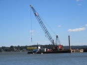
crane

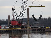
Crews operating barges, cranes and boats are at work this fall, 2018, building the breakwater in the Dyke Marsh Wildlife Preserve, the first stage of Dyke Marsh restoration.  The U.S. Geological Survey’s 2010 and 2013 studies identified building a breakwater as the first priority of restoration, a riprap structure designed to replicate the historic promontory removed by dredgers. 

Continue Reading

Bringing Back Native Plants

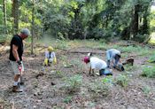
planting

The Mount Vernon Gazette, Connection Newspapers, published an article on our native plant restoration project.  You can read it here

Our partners are the National Park Service, Earth Sangha and the Audubon Society of Northern Virginia.  We also appreciate support from the National Environmental Education Foundation and Transurban.

Sign up to help us control invasive plants and make this project a success at This email address is being protected from spambots. You need JavaScript enabled to view it..

Dyke Marsh’s Submerged Aquatic Vegetation

Dr. Rybicki

Several FODMers learned about native and non-native submerged aquatic vegetation (SAV) of Dyke Marsh and the Potomac River on July 14, 2018, when Nancy Rybicki gave a tutorial and led a paddle.  Dr. Rybicki is an aquatic plant ecologist and wetlands scientist, retired from the U.S. Geological Survey.  In her 37 years of studying the vegetation of the Potomac River, she has correlated the presence of submerged aquatic vegetation with water quality.

Continue Reading

Butterflies, Dragonflies, Damselflies Delight

Needham's skimmer

On a beautiful, 82-degree, breezy July 7, 2018, 15 FODMers studied butterflies, dragonflies and damselflies and their host plants in the Dyke Marsh Wildlife Preserve and Belle Haven Park.

It was a Needham’s skimmer (Libellula needhami) day. These showy dragonflies were whizzing around everywhere and eating midges, making for easy sightings.  The males are bright reddish-orange and have a red face.  The females are yellow and black.  Both sexes and all ages have a black line on their abdomens and orange-tinted wings.

Continue Reading

Exploring the Ecology of Dyke Marsh

Charles Smith

On June 9, 2018, Dyke Marsh members and friends learned about Potomac River wetland ecosystems and the interrelationships of plants, insects, birds and other biota, on a walk on the Preserve’s Haul Road trail led by Charles Smith, expert naturalist and Chief of Fairfax County’s Stormwater Planning Division, Watershed Projects Implementation Branch. He also discussed human intervention and how native Americans used some of the marsh plants.

Continue Reading

Restoring Habitat – 2,000 Native Plants

Matt Bright

On June 9, 2018, twenty volunteers and National Park Service staffers planted another 1,000 native plants on a cleared .65-acre site along the Haul Road trail.  The site was previously overrun with non-native or invasive plants, like English ivy, mile-a-minute and stiltgrass.

Continue Reading

FODM Summary of All Public Comments

A Summary of Comments Submitted to the U.S. Army Corps of Engineers on the Proposed Belle Haven Floodwall and Levee 

On August 29, 2022, the Friends of Dyke Marsh (FODM) submitted a Freedom of Information Act (FOIA) request to the U.S. Army Corps of Engineers (ACE or Corps), requesting all comments and any suggested alternatives submitted to the Corps, on their Draft Integrated Feasibility Report and EA [IFR/EA] (May 2022) for the proposed Belle Haven floodwall and levee. That IFR/EA can be found at https://www.nab.usace.army.mil/Portals/63/docs/Civil%20Works/DC%20Coastal/DC%20Coastal%20-%20Draft%20Report%20-%20IFR_EA%20.pdf.

Image 3 18 23 at 5.58 PM   Floodwall Map

In a January 6, 2023, letter the Corps of Engineers responded to the FOIA request and provided FODM with 14 pdf files that total 371 pages. To protect individuals’ privacy the Corps redacted the identities of individuals who submitted personal comments but did not redact the identity of organizations and their representatives. The Corps’ cover letter FOIA response to FODM is one of the pdf files and is found here

While the Corps stated that the agency intends to only summarize the comments, the Friends of Dyke Marsh believes it is important for the public to have complete access to all of the submitted comments, verbatim, and not just the Corps’ summary of the comments. To that end and as a public service to the community, FODM is making available all of the comments provided to us in the Corps’ FOIA response. Among these files is the 14 pages of comments submitted by the Friends of Dyke Marsh, in which we contend that the Corps’ proposal is deficient and fails to consider other alternatives. All of these pdf files may be reviewed as well as downloaded at FODM’s website here. While the 371 pages are too lengthy and varied to be effectively summarized here, the following is a summary of the various comments that raised questions or concerns about the Corps’ Draft IFR/EA which proposes the location of the floodwall and levee on the west side of the Parkway: 

A.The two-page comments by the National Park Service’s (NPS) George WashingtonMemorial Parkway unit, dated July 29, 2022, are found here. Among other things, the GWMPstates, "For the NPS to provide meaningful comment, we would need to better understand thepotential to impact NPS resources. If there is infrastructure proposed on the GW Parkway or ifGW Parkway land would be temporarily required for the construction of infrastructure, then theEA would need to be explicit regarding what infrastructure, where it would be located, and howmuch land is required. Furthermore, the amount of impacts to NPS resources would need to beevaluated. As written, the EA is insufficient to adopt should the NPS be required to make afederal decision on the use of its properties." … “The NPS continues to be concerned withimpacts to NPS resources but remains open to ongoing coordination with the USACE to explorepotential measures that limit the effects of coastal flooding. Specifically, the NPS would likeUSACE to consider how Dyke Marsh might assist with mitigations to flooding impacts in theBelle Haven area.”

B.The five-page comments by the George Washington Memorial Parkway are found here. Among other things the comments state, “The report is informative and technicallycomprehensive, but it does not adequately address how the significance of the GeorgeWashington Memorial Parkway (GWMP) or how it is negatively affected by the NationalAirport and Belle Haven floodwalls (5c/alternative 8) and levies and the GWMP floodwalls(4a).”

C.The 280 pages of public comments by individuals and organizations are found here. The file contains approximately 158 comments. All but five were opposed to a proposed floodwalland levee or had “strong concerns” about the proposed floodwall, either because of its proposedlocation or because the commentors considered the Corps’ study to be inadequate or failing toconsider alternatives. While 17 comments request that the floodwall be constructed on the eastside of the Parkway, 42 comments request other flood mitigation options, including increasedfunding for restoration of Dyke Marsh and “elevating” the Parkway. While other comments didnot expressly urge that the floodwall be located on federal land, at least three stated that the NPSneeded to do more. Other comments noted that alternatives were not considered. One comment,at file page 115-118, asked why the Corps did not consider an entirely removable post and panelfloodwall, like the one that has been constructed by the Corps and NPS located at the NationalMall’s 17th Street, or the removable post and panels system that is manufactured by FloodControl America.

The following is a summary of comments from the organizations posted in the 280 page public comments document found here:

Rivers Towers Condominium Unit Owners Association at file pages 151-152 question the completeness of the study and add that “the lack of involvement of the NPS is shortsighted and suggest a lack of considered thought on the problem, as well as being contrary to the public good. We believe that, given the location of the NPS’s property along the Potomac, the NPS must be involved….” 

Ten organizations (the Audubon Society of Northern Virginia, Chesapeake Climate Action Network, Defensores de la Cuenca, Environmental Defense Fund, Friends of Dyke Marsh, Friends of Little Hunting Creek, Potomac Riverkeeper Network, Virginia Conservation Newtwork, Virginia League of Conservation Voters and Wetlands Watch (July 30, 2022)), submitted a joint comment at file pages 11-16 At file page 11, the organizations state that “we have several concerns with the findings, notably the failure to incorporate best available science and holistic flood risks into the study analysis, the minimal opportunities for meaningful public engagement within the last 18 months, the failure to include natural- and nature-based features (NNBF) in the analysis and Tentatively Selected Plan (TSP), and the incomplete assessment of potential environmental impacts.” 

The Audubon Society Northern Virginia (July 29, 2022), at file pages 40-44, commented, “It [the Corps’ feasibility report] fails to fully consider all alternative coastal flooding management approaches, the ACE’s rationale and the reasons for eliminating certain approaches. Among other flaws this study ignores the total river ecosystem of the middle Potomac River Basin; fails to include or provide for an ‘impairment assessment’ by the National Park Service; under-recognizes the historic designation and character of the George Washington Memorial Parkway; ignores further restoration of Dyke Marsh; understates wetlands flood control potential; inadequately addresses environmental impacts; and inadequately evaluates possible threatened and endangered species.” 

The Friends of Dyke Marsh (July 27, 2022) at file pages 50-64 list numerous deficiencies of the Draft IFR/EA, including the failure to consider a wide variety of alternatives. FODM’s complete comments are posted here

The Four Mile Run Conservatory Foundation (June 30, 2022), at file pages 125-128, expresses “strong concerns” about the floodwall. They include, at file page 127, that “The study’s treatment of environmental justice (EJ) is cursory. In section 4.2.10 (Environmental Justice), the study notes that Alternative 5a is the only one located in a census tract identified as an EJ community. While the benefit of coastal flood protection is noted in Table 4-2, the adverse EJ impacts of the project – permanent and temporary losses of recreational access, particularly for children in a community with a high proportion of children and youth – are not mentioned.” 

Mount Vernon Council of Citizen Associations, Inc. (July 27, 2022), at file page 167, states that they “strongly request that you stop the COE from moving forward and that you ensure they work with the impacted communities, the National Park Service and commercial businesses before they go any further with their ill-conceived planning.” On file page 168 the “MVCCA demands true community engagement and full disclosure by the COE, to include a new presentation of details and alternate plans for the residential areas and commercial areas.” 

D. The 10-page comments by Fairfax County (July 28, 2022) is found here. Among other things, at pages 6-7, county representatives state, “Staff notes that the proposal may negatively impact the George Washington Memorial Parkway, which would be located on the river side (to the east) of the proposed flood walls. Staff recommends that future environmental analysis of the project consider locations both to the east and west of the George Washington Memorial Parkway for the construction of the flood walls and levees to determine how to best respect the historic resource.” On page 8, it notes that: “Page V of the IFR/EA and Appendix F: Real Estate Plan estimates lands and damages real estate costs at $1,167,000. If the wall is largely located on private land (i.e., Belle View Condos, River Towers, and private residential properties) then this estimate seems very low.” On page 9, it notes that “The provided documents show the southern end of an earthen levee extending into Westgrove Park. Westgrove Park will experience direct impacts of lost land, recreation facilities, vegetation, and habitat, increased storm water discharge, invasive species, as well as wildlife habitat quality impacts.”

E. The six-page comments by the Environmental Protection Agency (EPA) (August 1, 2022) are found here. Among other things, on page 1, on Alternatives such as natural- and nature-based features (NNBF) EPA, “recommends the addition of NNBF to the TSP in the Final IFR/EA. As stated in Section 3.0, NNBF will be added as a design consideration to enhance the performance and effectiveness of the final array of alternatives. However, specific opportunities for adding NNBF were not identified in the Draft IFR/EA.” On page 2 on “Environmental Justice,” it states that “EPA appreciates the intent to identify underserved communities. However, it is unclear from the information provided whether the assessment is sufficient to fully identify potential communities with EJ concerns.” And that “using the 80th percentile or greater nationally, people of color populations may not be sufficiently evaluated.” On pages 3-4 on “Cultural Resources,” EPA states, “The potential impacts to resources under Section 106 of the National Historic Preservation Act are currently unclear. The Belle Haven neighborhood may need to be formally evaluated for listing on the National Register of Historic Places, archaeological surveys may be needed in the footprint of the proposed levee and floodwall, and the proposed floodwall may have viewshed impacts from historic resources such as the George Washington Memorial Parkway (GWMP) and the Mount Vernon Trail. Based on Sections 6.9 and 6.10, a Programmatic Agreement is currently being developed or will be developed with the Section 106 consulting parties for impacts. We recommend that the Final IFR/EA be updated with the status of consultation, the draft or final PA, resource impacts, and other relevant information.” On page 6 on “Aesthetics and Recreation,” EPA stated, “The proposed levee/floodwall at Belle Haven may permanently obstruct the view of the natural areas located south of Belle Haven and the GWMP. The IFR/EA indicates that the view from the lower floors of the River Towers Condominiums and from the community grounds and recreational areas would be obstructed. It appears that there may be both temporary and permanent impacts to aesthetics, but the severity of the impacts is currently unclear.” 

F. The 22-page comments by the Virginia Department of Environmental Quality (DEQ) (July 14, 2022) are here.1 On pages 9-10 of DEQ’s letter dated July 14, 2022, the agency states that “The submitted Draft Integrated Feasibility Report and EA shows no evidence that the Corps has considered the impacts of the proposed feasibility study and construction activities on locally-designated CBPA [Chesapeake Bay Preservation Act] lands in the proposed project areas. While the CZMA Enforceable Policies section of the FCD includes considerations of Tidal and Non-Tidal Wetlands, Subaqueous Lands, Wildlife and Inland Fisheries, Point Source Air Pollution and Non-point Source Water Pollution, there is no mention made (and no analysis of) the Chesapeake Bay Preservation Areas enforceable policy. The proposed study area and the locations of proposed construction activities associated with the proposed floodwalls are both within locally-designated CBPA lands, and are as such subject to the Regulations.” 

1 This FOIA file has a total of 44 pages and also contains internal letters to VaDEQ from the Virginia Marine Resources Commission (June 30, 2022)(2 pages), Department of Environmental Quality (June 3, 2022), Department of Conservation and Recreation (July 6, 2022)(4 pages) as well as several internal memos to the VaDEQ , some of which came from its Division of Land Protection & Revitalization Review Coordinator (June 28, 2022)(2 pages), from the DEQ Principal Environmental Planner (June 3, 2022)(4 pages), from the Northern Regional Office (June 24, 2022)(2 pages).

G. The four-page comments by the Fairfax County Park Authority (July 31, 2022) are found here. Among other things, they state that the proposed floodwall and levee would extend “approximately 100 linear feet into the FCPA’s Westgrove Park…. [and if constructed the park] will experience direct impacts of lost land, recreation facilities, public access, vegetation, and habit, increased water discharge, invasive species, as well as wildlife quality impacts. The DIFR & ER includes limited information addressing Westgrove Park in the analysis of environmental effects and consequences. FCPA requests further coordination and consultation to ensure impacts to Westgrove Park by the proposed project are avoided, minimized, or mitigated.” 

H. The three-page comments by the Virginia Department of Wildlife Resources (July 28, 2022) are found here. Among other things, they are “recommending protections for the aforementioned species and resources, from the immediate impacts of construction activities associated with this project, we are also concerned about longer-term impacts that the altered hydrology and sedimentation patterns, resulting from the installed coastal stormwater infrastructure, might have on resources under our jurisdiction. These concerns extend to wildlife resources in the Arlington and Alexandria project areas as well as those in connected systems. We recommend continued investigation into any such impacts, particularly those upon wetland and riverine systems in the Potomac watershed, and application of the best available science on the ecological impacts of coastal stormwater management infrastructure (still in early development) to project plans and implementation.” … 
“We recommend that the stormwater controls for this project be designed to replicate and maintain the hydrographic condition of the site prior to the change in landscape. This should include, but not be limited to, utilizing bioretention areas, and minimizing the use of curb and gutter in favor of grassed swales. Bioretention areas (also called rain gardens) and grass swales are components of Low Impact Development (LID). They are designed to capture stormwater runoff as close to the source as possible and allow it to slowly infiltrate into the surrounding soil. They benefit natural resources by filtering pollutants and decreasing downstream runoff volumes.” 

I. The five-page comments by the National Marine Fisheries Service (July 28, 2022) are found here. Among other things, the NMFS states that “based on the site location (i.e., upland of the tidal freshwater portions of the Potomac River), the proposed action is unlikely to present adverse impacts to EFH [essential fish habitat].” Further, “Based on the information in the plan, it appears that these two stream channels upstream of the project area, termed Belle Haven ’East’ and ’West’ channels, respectively, have been historically modified (e.g., straightening) and likely have a hydrology typical of urbanized streams (e.g., highly variable flows). While these proposed culverts will likely further alter the hydrology of these small streams, it appears that such impacts to tidal wetlands associated with Hog Island Gut would be largely avoided in the currently proposed alignment. However, culverts should be designed to avoid creating barriers for fish movement and/or causing downstream scour, to the extent possible.” … “As proposed, the project may result in degradation of riverine habitat. To avoid and minimize these impacts, we recommend the following measures be incorporated to the extent possible, pursuant to the Fish and Wildlife Coordination Act (FWCA): Design proposed culverts to allow for the movement of aquatic organisms[;] Incorporate measures to minimize the amount of turbidity generated by in-water work, notably during the anadromous fish spawning season (March 1 - June 15).” … “Threatened or endangered species under our jurisdiction including Atlantic sturgeon (Acipenser oxyrhynchus) may be present in the project area. As the lead federal action agency, you are responsible for determining the nature and extent of effects and for coordinating with our Protected Resources Division as appropriate.”

J. The two-page comments and various emails, by the Metropolitan Washington Airport Authority (August 12, 2022) are found here. Their comments focus on the possible impact on Reagan National Airport and do not address the proposed Belle Haven floodwall or levee. 

K. The two-page comments by Arlington County July 31,2022) are found here. Their comments focus on the proposed floodwall along the Arlington Water Pollution Control Plant and do not address the proposed Belle Haven floodwall or levee. 

L. Two pages of internal and external email exchanges are found here. On file page 1, the Corps responded to one inquiry, stating “The final report will be posted online; however, comments will likely not be displayed verbatim, but summarized due to the magnitude of comments.” 

M. One-page of an internal and external email exchange about whether comments will be published by the Corps, is found here. File page 1 is a Corps email response to an email dated August 26, 2022 that state: “The comments submitted on this study are currently being reviewed and addressed. A summary of the comments will be included in the final report, which is anticipated to be posted in late summer 2023/fourth quarter of federal fiscal year 2023, after it has gone through necessary internal and partnership reviews.” 

For a copy of this summary in PDF format, click here.

All Comments Submitted to the U.S. Army Corps of Enginerers

Each numbered item below links to the document described.

1. Response cover letter from the Corp of Engineers to the FOIA request from R. Myers, FODM Board member

2. Fairfax County comments, redacted

3. DC Coastal Public comments - 280 pages - redacted

4. Arlington County comments, redacted

5. U.S. Environmental Protction Agency comments, redacted

6. Fairfax County Park Authority comments, redacted

7. U.S. Army Corps of Engineers - Baltimore District comments, Part 1, asking question, redacted

8. U.S. Army Corps of Engineers - Baltimore District comments, Part 2, redacted

9. George Washington Memorial Parkway comments

10. Metropolitan Washington Airports Authority comments

11. National Marine Fisheries Service, Greater Atlantic Regional Fisheries Office comments, redacted

12. National Park Service comments, redacted

13. Virginia Department of Environmental Quality comments, redacted

14. Virginia Department of Wildlife Resources comments, redacted

Reaching Out to Neighbors

Youngster

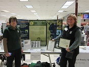
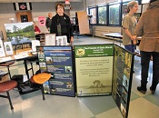
The Friends of Dyke Marsh shared a table with the Friends of Huntley Meadows Park on June 16, 2018, at the annual Community Day in Gum Springs, a historically African-American community near the Dyke Marsh Wildlife Preserve.

FODMers Catherine Noonan and Mary Luceri greeted many festival-goers and helped youngsters make colorful birds.  T-Rex and his “friend” dropped by and entertained all.  The event drew 32 vendors and organizations, elected officials, a steel drum band and many guests.

Continue Reading

Battling Invasives, Protecting Natives

Brent Steury

Keeping non-native, invasive plants out of the native plant restoration area along the Haul Road trail is a long-term challenge and efforts began on June 5, 2018, when ten volunteers participated in a training led by National Park Service (NPS) biologist Brent Steury.  Brent stressed that the two priority plants to try to control are Japanese stiltgrass (Microstegium vimineum) and mile-a-minute (Polygonum perfoliatum).  He urged volunteers to pull them out of the ground before they set seed.  “If they set seed, we’ve lost,” he stressed.

Continue Reading

Bald Eagles Fledged in Early June

eagle nest

There were three active bald eagle (Haliaeetus leucocephalus) nests in the Dyke Marsh Wildlife Preserve this year, 2018.  We will soon report the number of eaglets that successfully fledged. During the week of June 4, “our” eagles, this year’s birds, left the nest.  Many visitors enjoyed observing them, especially those nesting near the Haul Road trail.

Continue Reading

Home     Map     Contact Us       fb       IG